Tippon Survyor in Hyderabad
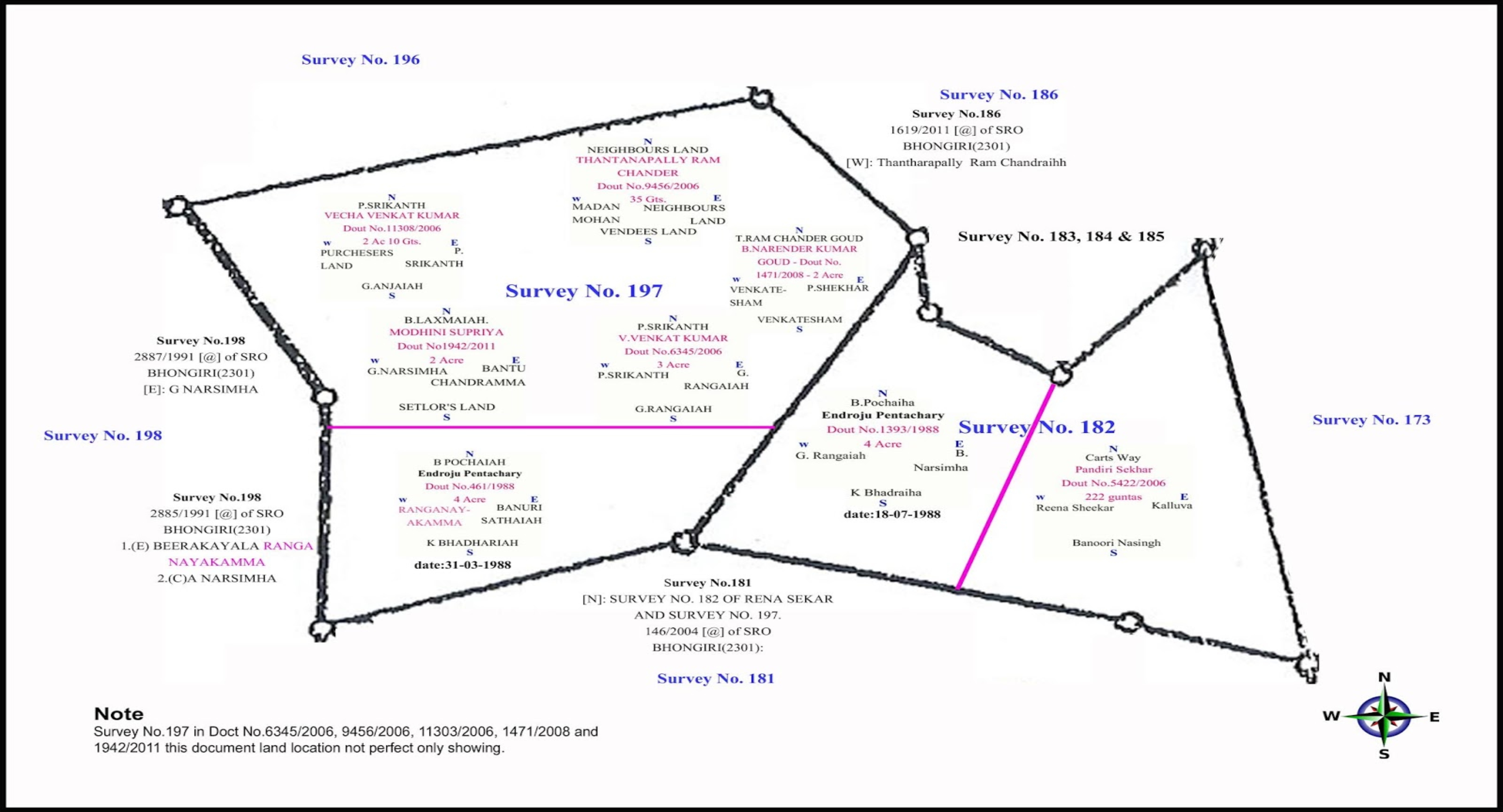
Tippon Survyor in hyderabad(Tippon Survyor hyderabad)Tippan is a basic survey document prepared in the field while doing a survey. It is a document that contains parcel-wise field measurements (For each survey boundary). Most of the maps available are hand-drawn and not to scale. This module is very simple and helps you to create the Tippan Maps to scale in very simple steps. It’s a collection of LISP Routines which simplify every step in creating a Tippan Boundary by eliminating the efforts of converting measurement units, drawing perpendiculars and changing dimensions.
-
Create ladders by reading the data directly from the field book by
eliminating the process of typing them into text format and then
converting them as drawings or create every single component in CAD
packages.
-
Draw perpendiculars easily
-
Adjust ladder lengths easily
-
Measure Distance between points, and Clockwise/Anti-Clockwise Bearings
of entities easily
-
Create Boundary automatically by referring to the Ladder Diagram
-
Create dimensions of ladder entities and boundaries along with the area in
a single command
-
Get the dimensions in both Acres - Gunthas and Metric System Create
Base Triangle and Sub Triangle and generate Tippan Map